6 Days The highest peak of Africa Machame Route
No of Days
6 Days | 5 Nights
Price From
$ 2570 Per Person
Departure dates
Any day of your choice
Climbing Overview
The machame route, known as the whiskey route, got its reputation for being tough climb, and is slightly more challenging than the other routes, a six days route is challenging, the day walks are longer and steeper; however the summit night is one hour shorter. An extra day used on the seven day climb makes it much easier than the six night climb, offering a better chance of success. the scenic traverse of the western breach offers some stunning views! machame route does not have sleeping huts, only tents accommodation available.
Full Itinerary

Machame Gate (1828m) - Machame camp (3020m)
Forest section Machame routeYour day starts early with breakfast, followed by a 45-minute drive from Moshi (910m) to the Machame Gate (1828m). The guides and porters prepare and pack the supplies and your equipment at the gate.
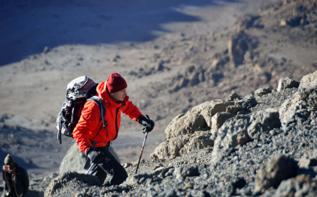
After registering at the gate office, you start your ascent and enter the rain forest almost immediately. There is a strong possibility of rain in the forest, which will transform the trail into a very soggy, muddy and slippery experience. You will have a welcome lunch stop about halfway and will reach the Machame camp (3020m) in the late afternoon.
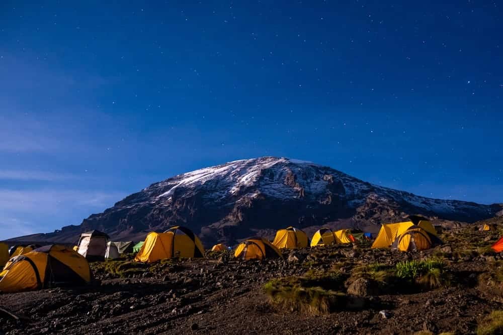
Your porters (arriving at the camp site long before you) will have erected your tent on arrival. In the evening the porters will bring a small bowl of washing water to your tent and the cook will prepare dinner, before you retire to your tent for the night. Night temperatures can already drop to freezing point at this campsite
Hiking time: 7 hours
Distance: Approximately 10.8 km
Machame camp (3020m) - Shira camp (3847m)
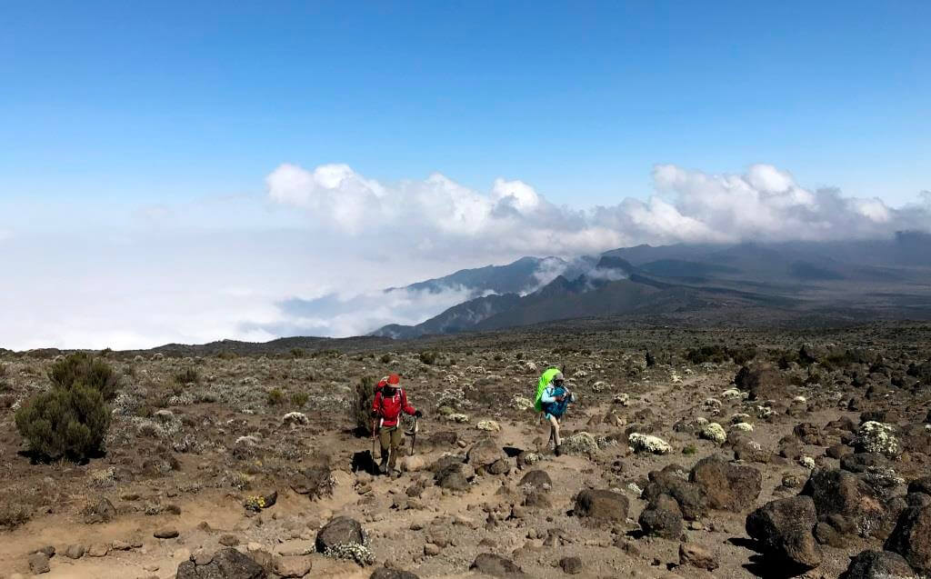
On the way to Shira camp you rise early at Machame camp and after breakfast you climb an hour or so to the top of the forest and then for 2 hours at a gentler gradient through the moorland zone. After a short lunch and rest, you continue up a rocky ridge onto the Shira plateau.
By now you will be able to see in an easterly direction, the Western Breach with its stunning glaciers. You are now due west of Kibo and after a short hike you will reach the Shira campsite at 3 847m. The night at this exposed camp will even be colder than the previous night, with temperatures dropping to well below freezing.
Hiking time: 6 hours
Distance: Approximately 5.2 km
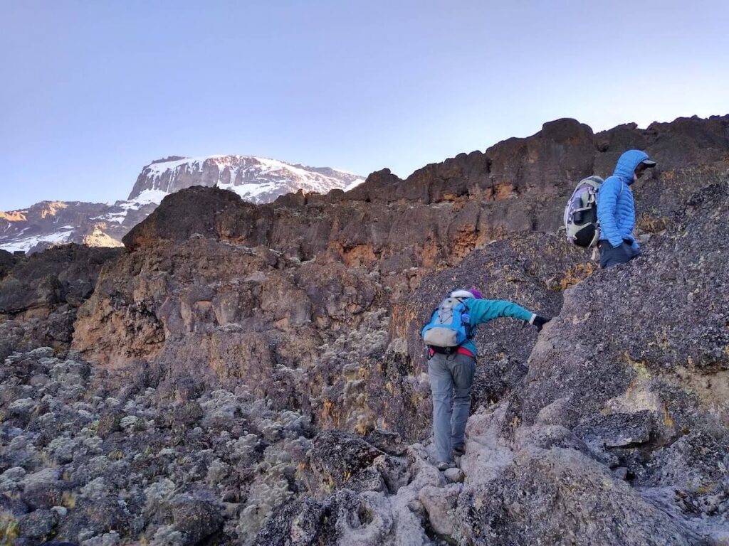
Shira Camp (3847m) to Lava Tower (4642m) to Barranco camp (3984m)
Lava TowerThe route now turns east into a semi desert and rocky landscape surrounding Lava Tower, where you reach an altitude of 4642m after about a 5 hour trek.
Lunch is served at a designated area. This is definitely the toughest day so far. It is normally around this point, where for the first time, some climbers will start experiencing symptoms of breathlessness, irritability and headaches. After lunch you descent again by almost 658m to the Barranco camping area.
After reaching the high altitude of 4600m at Lava Tower, the true acclimatisation benefit of this day becomes clear. This descent to Barranco camp takes about 2 hours and offers great opportunities to take some beautiful photographs of the Western Breach and Breach Wall.
The camp is situated in a valley below the Breach and Great Barranco Wall, which should provide you with a memorable sunset while you wait for your dinner to be prepared.
Hiking time: 7 hours
Distance: Approximately 10.7 km
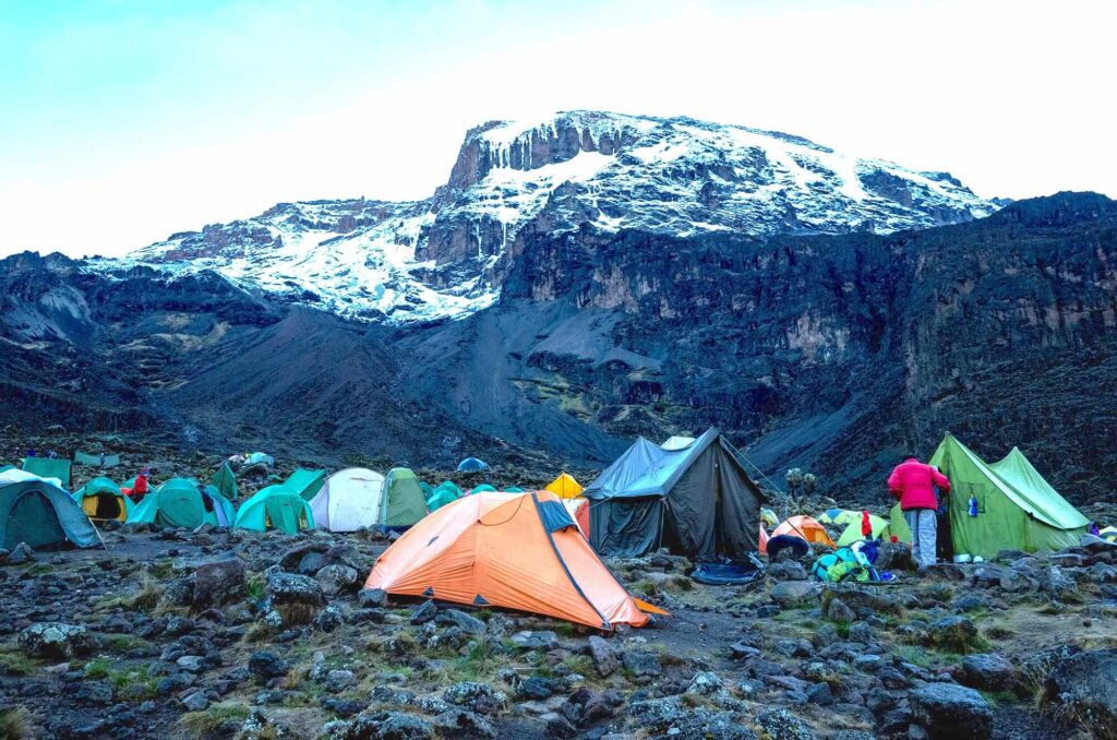
Barranco camp (3984m) - Barafu camp (4681m)
On the way to Barafu campAfter spending a night at the great Barranco Wall (a very imposing sight at first), you make your way up this awesome looking obstacle, which in the end usually turns out to be easier than anticipated. Topping out just below the Heim Glacier, you will now appreciate just how beautiful Mount Kilimanjaro really is.
The route then heads down through the Karanga Valley over intervening ridges and valleys, and then joins up with the Mweka route. This is the preferred route down from the summit, so remember it. Turn left up the ridge and after another hour or so, you should reach Barafu Hut.
The last water stop on the route is the Karranga Valley, as there is no water available at Barafu camp. Barafu is the Swahili word for “ice” and it is a bleak and inhospitable camping area to spend the night. Totally exposed to the ever-present gales, the tents are pitched on a narrow, stony, and dangerous ridge. Make sure that you familiarise yourself with the terrain before dark to avoid any accidents.
The summit is now a further 1214m higher and you will commence with your final ascent attempt, the same night. Prepare your equipment, hiking poles and thermal clothing for your summit attempt. This should include the replacement of your headlamp and camera batteries and make sure you have a spare set available as well. To prevent freezing it will be wise to carry your water in a thermal flask. Go to bed at round about 19h00 and try to get some precious rest and sleep.
Hiking time: 8 hours
Distance: Approximately 9.4 km
Summit attempt,Barafu camp (4681m)-Uhuru Peak (5895m)-Mweka (3090m)
View from Stella point You will get up around 23h30, and after some tea and biscuits you shuffle off into the night. You will head in a north-westerly direction and ascend through heavy scree towards Stella Point on the crater rim.
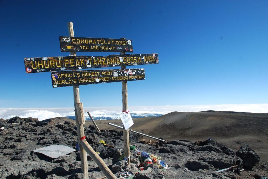
For many climbers the 6-hour walk to Stella point is mentally and physically the most challenging on the route. At Stella Point (5739m) you will stop for a short rest and will be rewarded with the most magnificent sunrise you are ever likely to see (weather permitting). From Stella Point you will normally encounter snow all the way on your 2-hour ascent to Uhuru Peak.
The time you will spend on the summit will depend on the weather conditions. Do not stop here for too long, as it will be extremely difficult to get going again due to cold and fatigue. Uhuru peak Enjoy your accomplishment and a day to remember for the rest of your life!
The walk back to Barafu from the summit, takes about 3 hours. Here you will have a well-earned but short rest and collect the rest of your gear, before heading down to Mweka hut (3090m). The route is not difficult and will take you down the rock and scree path into the moorland and eventually into the forest. Dinner and overnight at mweka camp.
Hiking time: 7 to 8 hours to reach Uhuru Peak, 6 to 8 hours to descend to Mweka Camp
Distance: Approximately 4.5 km ascent and 10.8 km descent
Mweka camp (3090m) - Mweka Gate (1641m)
The mountain crew team After an early and well-deserved breakfast, it is a short 4 to 6 hour and scenic hike back to the park gate. Some hikers do experience knee problems which could make the descend longer than planned.
At Mweka gate you sign your name and details in a register. This is also where successful climbers receive their summit certificates. Those climbers who reached Stella Point (5739m) are issued with green certificates and those who reached Uhuru Peak (5895m) receive gold certificates.
From the Mweka Gate you will drive to lodge or hotel in Arusha for a long overdue hot shower, celebrations evening drive to Kilimanjaro airport for your international flight.
Distance: Approximately 8.5 km,
Hiking time: 4 to 6 hours
Price Per Person
| No.of Pax | Price Per Person |
|---|---|
|
2 |
USD 5000 |
|
3 |
USD 5000 |
|
4 |
USD 5000 |
|
5 |
USD 5000 |
|
6 |
USD 5000 |
Book this Tour
Inclusions
- Ground Transport in Tanzania
- Park and camping fees
- Rescue fees
- Camping equipment – sleeping bags
- One nights’ accommodations in Arusha/Moshi, i.e. before the climb
- Experienced English speaking mountain guide
- Guides and porters
- Cook
- Full board during the climb
- Government taxes
Exclusions
- International flight
- Tipping
- Personal equipment’s such as warm and rain gears.
